In one step, update with GEOTAGS each photo in an on-line web album using latitude/longitude data from a file stored on the phone.
For those using cameras without built-in GPS, integrated GPS can be approximated by using android phone's apps such as MyTracks to record data while the photos are being taken. Once the photos have been uploaded to either Picasa or to G+, run the app on the phone, selecting the album and the GPS data and all the on-line photos will have GPS data applied to them.
Use GPS data from any third party app that saves as GPX
Use online photo albums -Picasa
Correlate albums to GPS data using Timestamps
Automatic updates to every photo from an album
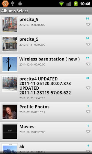

Select an album from your online list as you see above. Select a gpx file from your phone as in right-hand side above. The GPS data from the file you selected on the right will be applied to photos in the album selected from left-hand side.
edit the various '.properties' files in root dir
get developer keys for the Picasa/+ API
https://developers.google.com/+/api/
edit clientcustomssl.java with your key values
build as normal android/ant project